I work with both undergraduate as well as graduate (doctoral and masters) students on a variety of research projects focusing on different aspects of urban rivers, water resources, and interaction of communities with river landscapes. My students come from various backgrounds and we work closely to address different research questions. Our research projects are interdisciplinary in nature and involve a suite of filed surveys (qualitative & quantitative), geo-spatial modeling, applied environmental statistics and archival work. I am currently working with students across different institutions.
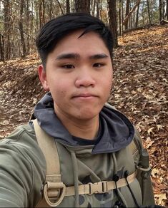
Jeffrey Chen
Undergraduate Researcher, Since 2023, Department of Geography and Anthropology, Kennesaw State University
Jeffrey is a geospatial sciences major at Kennesaw State University with a concentration in human-environmental systems and minor in geography. His work focuses on using GIS and Cyclone 3dr for landscape modeling. He likes hiking and camping on his free time.
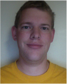
Brian Udell
Undergraduate Researcher, Since 2022, Department of Geography and Anthropology, Kennesaw State University
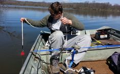
Brian is a geography major at Kennesaw State University. He is currently working on developing various instructional tools related to using geospatial technologies and field methods in river surveys, riparian corridors, reservoirs sedimentation surveys, management of land fill sites, and flume experiments.
Undergraduate Researcher, Since 2022, Department of Geography and Anthropology, Kennesaw State University
Brian is a geography major at Kennesaw State University. He is currently working on developing various instructional tools related to using geospatial technologies and field methods in river surveys, riparian corridors, reservoirs sedimentation surveys, management of land fill sites, and flume experiments.
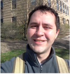
Tristan Bollenbaugh
Undergraduate Researcher, Since 2022, Department of Geography and Anthropology, Kennesaw State University
Tristan is a geospatial sciences major at Kennesaw State University with a concentration in human-environmental systems. He is currently working on 3d modeling of fluvial systems using field based terrestrial point cloud data. Tristan transitioned from a career as a software implementation project manager to a full-time college student. His broad academic interests include the applied aspects of LiDAR technology in earth science with an emphasis on river science.
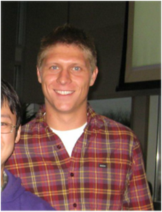
Burton Blackmar
Undergraduate Researcher, Since 2022, Department of Geography and Anthropology, Kennesaw State University
Burton is a geospatial sciences major at Kennesaw State University with a concentration in land surveying. He has worked with his father on land surveying since he was young and found the work enjoyable enough to pursue the career himself. He has experience in AutoCAD, Civil3D, and Carlson, along with using robotic instruments for data collection in the field. He is currently working on using the point cloud data to analyze streambed profiles.
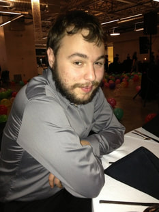
Derek Romanek
Undergraduate Researcher, Since 2022, Department of Geography and Anthropology, Kennesaw State University
Derek is majoring in Geospatial Spatial Sciences with a concentration in Human-Environment. His areas of interest include spatial analysis with ArcGIS, leadership and team building for applied projects. His research focuses on using field based terrestrial LiDAR data to analyze the morphology of low order streams.
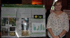
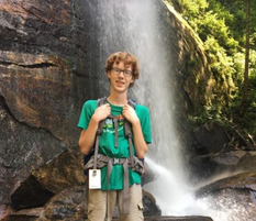
Erienne Davis
Masters Student, 2017-2019, Department of Geography, Western Illinois University
Erienne is working on determining the rates of stream bank erosion in the head water alluvial channels. Her work focuses on using terrestrial LiDAR technology to surveys the bank profiles over different time periods. It involves the point cloud data with a suite of software packages. She just won the third place among the masters student paper competition at the Annual Conference of the West Lakes Division of the American Association of Geographer (October 1-3).
Jacob Sneade
Undergraduate Researcher, 2017-2019, Department of Information Systems, Western Illinois University
Jacob is working on the application of point cloud data from terrestrial LiDAR for a variety of research applications including:
- Developing riverscapes of full length urban streams
- Estimating the bed roughness of creeks in the urban areas
- Temporal change in the channel morphology with minimal human impact versus fully urbanized landscape
- Variability of channel morphology with changing sample size
Paige Ehrecke
Masters Student, 2016-2018, Department of Geography, Western Illinois University
Paige worked on analyzing the stream bank response to different types of vegetation treatments over time. It involved multiple experiments on the banks of low order streams. Her work is a suite of geomorphology, plant biology and geo-spatial modeling.
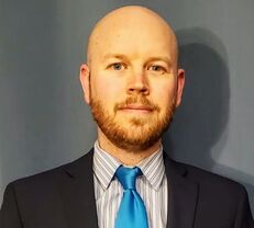
Jonathan Adams
Masters Student, 2014-2016, Department of Geography, Western Illinois University
John is working for his masters thesis on the sediment dynamics of a small urban drinking water source. His work focuses on a case study of Spring Lake reservoir in Macomb, IL. This project involves field surveys of sediment depth and spatial interpolation methods to understand changes in the lake bed profile. The resulting lake bed profiles will be used to determine temporal sediment routing in the lake.
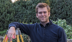
Mark Lundine
Undergraduate Student, 2016-2017, Geology and Mathematics with a minor in Physics, Augustana College
Mark worked on using Cyclone Suite for processing Terrestrial LiDAR data and developing point clouds of low order stream profiles. His work also involved the application of Structure from Motion to analyze fluvial landscapes in different regions.
Sally Riccardi
Undergraduate Student, 2013-2014 (Meteorology), Department of Geography, Western Illinois University
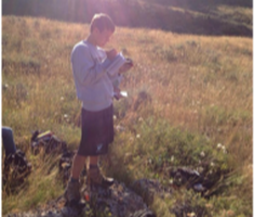
Sally worked on the potential effects of Tar Sand pipeline on the socio-ecological landscapes of the Mid-West. Using a case studies of oil spill in Kalamazoo, this project evaluated the potential spatial implications of Tar Sand pipeline on natural and human resources.
Undergraduate Student, 2013-2014 (Meteorology), Department of Geography, Western Illinois University
Sally worked on the potential effects of Tar Sand pipeline on the socio-ecological landscapes of the Mid-West. Using a case studies of oil spill in Kalamazoo, this project evaluated the potential spatial implications of Tar Sand pipeline on natural and human resources.
Joshua Smith
Undergraduate Student, 2013-2014, Department of Geology, Western Illinois University
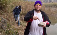
Josh traveled with me to India for field work at different check dam sites which represent different stages in the life span of these small scale dams. His work involved hydrogeomorphic surveys of dams sites, archival research on the study areas and geo-spatial analysis of field data. The field work in India was supported by a grant from the National Science Foundation. This project is part of a larger interdisciplinary project with collaborators from Geology, Cultural Geography and Agricultural Geography. Josh majored in geology with a minor in GIS
Undergraduate Student, 2013-2014, Department of Geology, Western Illinois University
Josh traveled with me to India for field work at different check dam sites which represent different stages in the life span of these small scale dams. His work involved hydrogeomorphic surveys of dams sites, archival research on the study areas and geo-spatial analysis of field data. The field work in India was supported by a grant from the National Science Foundation. This project is part of a larger interdisciplinary project with collaborators from Geology, Cultural Geography and Agricultural Geography. Josh majored in geology with a minor in GIS
Jonathan Bergan
Undergraduate Student, 2014-2015, Department of Geology, Western Illinois University
Jon worked on using high resolution LIDAR data to create channel profiles in urban and rural watersheds for a comparative analysis to determine the effects of changing landcover channel morphology. The project also involves field surveys of selected sites for error analysis of the LIDAR data. Jon is majoring in Geology with an emphasis on GIS.
James Cundiff
Undergraduate Student, 2013-2014 (Meteorology), Department of Geography, Western Illinois University
James conducted a research project on analyzing the ecological health of Sugarland Run due to rapid urban sprawl in Loudon and Fairfax counties in Virginia. As a meteorology major, James brought in a suite of both atmospheric and geomorphic components in this project.
Nicholas Sotto
Undergraduate Student, 2013-2015, Department of Geography, Western Illinois University
Nicholas worked on changing flood plains boundaries of Pool-19 of the Mississippi River with the help of both GIS and archival data. His project will related the changes in the flood plain boundaries with sedimentation and invasive species in the Pool-19.
Caleb Mackey
Undergraduate Student, 2010-2011, Department of Geography, Western Illinois University
Caleb used GIS and Remote Sensing methods to analyze the changes in riparian corridor and land cover of Sugarland Run over different periods of time.
Undergraduate Student, 2010-2011, Department of Geography, Western Illinois University
Caleb used GIS and Remote Sensing methods to analyze the changes in riparian corridor and land cover of Sugarland Run over different periods of time.

Jonathon Hamilton
Masters Student, Department of Geography, Western Illinois University
Jon worked on using GIS analysis to determine the topographical relationships for the functioning of wind farms. His research involves a blend of spatial interpolation, meteorology, and environmental statistics.
Masters Student, Department of Geography, Western Illinois University
Jon worked on using GIS analysis to determine the topographical relationships for the functioning of wind farms. His research involves a blend of spatial interpolation, meteorology, and environmental statistics.
Jeremy Birkey
Masters Student, 2013 -2014, Department of English & Journalism, Western Illinois University
Jeremy worked on the public representation of sea level rise among low-lying islands. His thesis evaluated how the effects of sea level rise on low-lying island nations are communicated to an American audience. This project involved examining the frames and rhetoric of publications, such as the extent to which an author frames an article with economics, morality or timescales. Jeremy illuminated how the public reception of issues such as climate change are dependent on the different valuations people apply."
